
Product
Windmill Micrositing
Paste your WTG coordinates and reneGIS audits every wind turbine generator against neighbouring developers, your own layout and the constraints around the site, then shows every conflict on a satellite map.
- 1
No hassle of manually measuring the proximity distances
Paste the coordinates and every distance between your WTGs, the neighbouring developers' WTGs and the constraints around the site is measured for you.
- 2
Accurate distances computed numerically
Every distance is worked out on the WGS84 ellipsoid from the coordinates themselves, not read off a map, and reported in metres with its direction.
- 3
Input all the constraints and the tool does the analysis
Other projects' WTGs, dwellings, EHV lines, roads, railways, buildings and government land go in as points, lines or polygons, and every WTG of yours is checked against all of them in one run.
What every WTG is checked for
Multi-clash detection: a WTG that conflicts with several neighbours reports all of them, with distance and direction, and a clear status for every WTG of yours.
Direct distance clash
Two WTGs are closer than 5 rotor diameters (5D), regardless of angle.
Directional wake clash
A WTG in the 5D to 7D band sits inside the prevailing wind corridor of a competitor.
Safe WTG
Beyond 7D, or inside 5D to 7D but outside the wake corridor, with the safe angle reported.
Too close to a constraint
Inside 500 m of a dwelling cluster, or closer than hub height + half rotor + 5 m to a road, railway, EHV line, building, public institution or government land.
Keep clear of what the rules protect
The 2024 micrositing guidelines ask for 500 m from dwellings and a tip-height clearance from roads, railways, EHV lines, buildings, public institutions and government land. Add them as points, lines or polygons, import them from Google Earth (KML or KMZ) or pick them from your library, and every WTG of yours is checked against them in the same run, at no extra cost.
Dwellings
Trace a village or hamlet as a polygon. Every WTG must stay 500 m from its edge, or the distance your state prescribes.
Roads, railways and power lines
Enter a road, track or EHV line as a line with its width. WTGs keep hub height + half rotor + 5 m clear, worked out per turbine.
Buildings and land
Buildings, public institutions and government plots as points or polygons, each with its own clearance. Anything inside a plot is flagged.
See every conflict on the map
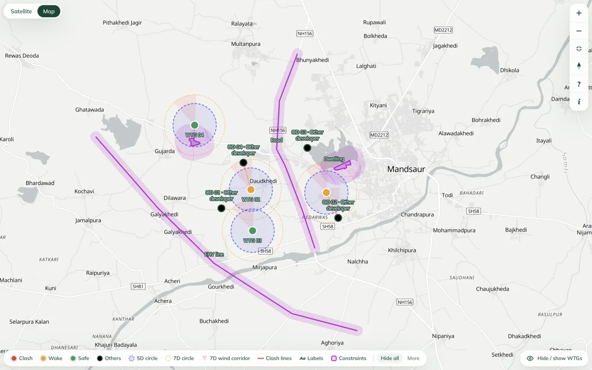
Every run opens on a satellite map of your layout and your neighbours', so a clash is something you can see, not a row you have to decode.
Clashes at a glance
Each of your WTGs is coloured by its result: clash, wake or safe. Neighbouring WTGs appear as white pins labelled with their company.
Spacing and wind zones
The 5D and 7D spacing circles and the downwind corridor are drawn around every WTG, so you can see why each result came out the way it did.
Constraints on the map
Villages, roads, railways and power lines appear with their clearance zone drawn to scale, and a line joins any WTG that sits too close.
Who clashes with whom
A line joins every clashing pair. Click a WTG to list each conflict with its distance and direction.
Your view, your way
Recolour or hide any layer, hide individual WTGs, switch between satellite and street map, and go full screen with a true-north compass.
Share what you see
Export the current view as a PNG with legend, compass and scale bar, or download Excel and Google Earth KML.
Fix and check again
Move a WTG in the input sheet and run again. Within 30 days, only the WTGs you changed are charged; constraints are always free.
How it works
- 1
Paste your coordinates
Your WTGs, then optionally every competitor coordinate you hold and the villages, roads, railways and power lines nearby, straight from the spreadsheet into a grid that works like one, or imported from a Google Earth KML. Lat/lon, DMS or UTM.
- 2
Set the wind, run
Turn the compass to the prevailing wind, set the default rotor. The audit finishes in seconds and charges credits only for your own WTGs.
- 3
Read, fix, export
A map and table of every clash with distance and bearing. Download the sheet as Excel or the map as KML for Google Earth, then re-run free after moving WTGs.
Start free
2,500 free credits on signup
Enough to audit up to 25 WTGs against every neighbouring coordinate you hold. No card, no password, and everyone on your company email domain shares the balance.