
UTM zone of every Indian state and union territory, with maps
The UTM zone for all 36 Indian states and union territories, MP, UP, Gujarat, Tamil Nadu and the rest, computed from official boundaries, with a map for each, the EPSG code and an example coordinate.
· 12 min read · reneGIS team
Quick answer: India lies in UTM zones 42N to 47N (WGS84, EPSG:32642 to 32647). 15 of the 36 states and union territories sit in a single zone; the other 21 are crossed by a zone boundary. Find yours in the table, then jump to its section for the map and an example coordinate. Zone shares were computed from official state boundaries, not estimated.
| State or union territory | UTM zone | Central meridian | EPSG |
|---|---|---|---|
| Andaman and Nicobar Islands (A&N, Andaman) | 46N | 93°E | 32646 |
| Andhra Pradesh (AP) | 44N, 43N and 45N | 81°E / 75°E / 87°E | 32644 / 32643 / 32645 |
| Arunachal Pradesh (Arunachal) | 46N and 47N | 93°E / 99°E | 32646 / 32647 |
| Assam | 46N and 45N | 93°E / 87°E | 32646 / 32645 |
| Bihar | 45N and 44N | 87°E / 81°E | 32645 / 32644 |
| Chandigarh | 43N | 75°E | 32643 |
| Chhattisgarh (CG) | 44N and 45N | 81°E / 87°E | 32644 / 32645 |
| Dadra and Nagar Haveli and Daman and Diu (DNHDD, Daman and Diu) | 43N and 42N | 75°E / 69°E | 32643 / 32642 |
| Delhi (NCT, New Delhi) | 43N | 75°E | 32643 |
| Goa | 43N | 75°E | 32643 |
| Gujarat (GJ) | 42N and 43N | 69°E / 75°E | 32642 / 32643 |
| Haryana (HR) | 43N | 75°E | 32643 |
| Himachal Pradesh (HP, Himachal) | 43N and 44N | 75°E / 81°E | 32643 / 32644 |
| Jammu and Kashmir (J&K, JK) | 43N | 75°E | 32643 |
| Jharkhand (JH) | 45N and 44N | 87°E / 81°E | 32645 / 32644 |
| Karnataka (KA) | 43N and 44N | 75°E / 81°E | 32643 / 32644 |
| Kerala (KL) | 43N | 75°E | 32643 |
| Ladakh | 43N and 44N | 75°E / 81°E | 32643 / 32644 |
| Lakshadweep | 43N | 75°E | 32643 |
| Madhya Pradesh (MP) | 44N and 43N | 81°E / 75°E | 32644 / 32643 |
| Maharashtra (MH) | 43N and 44N | 75°E / 81°E | 32643 / 32644 |
| Manipur | 46N | 93°E | 32646 |
| Meghalaya | 46N and 45N | 93°E / 87°E | 32646 / 32645 |
| Mizoram | 46N | 93°E | 32646 |
| Nagaland | 46N | 93°E | 32646 |
| Odisha (Orissa) | 45N and 44N | 87°E / 81°E | 32645 / 32644 |
| Puducherry (Pondicherry) | 44N and 43N | 81°E / 75°E | 32644 / 32643 |
| Punjab (PB) | 43N | 75°E | 32643 |
| Rajasthan (RJ) | 43N and 42N | 75°E / 69°E | 32643 / 32642 |
| Sikkim | 45N | 87°E | 32645 |
| Tamil Nadu (TN) | 44N and 43N | 81°E / 75°E | 32644 / 32643 |
| Telangana (TS, TG) | 44N and 43N | 81°E / 75°E | 32644 / 32643 |
| Tripura | 46N | 93°E | 32646 |
| Uttar Pradesh (UP) | 44N, 43N and 45N | 81°E / 75°E / 87°E | 32644 / 32643 / 32645 |
| Uttarakhand (UK, Uttaranchal) | 44N and 43N | 81°E / 75°E | 32644 / 32643 |
| West Bengal (WB) | 45N | 87°E | 32645 |
Not sure which side of a boundary your site is on? Drop a pin or search a place in the UTM Zone Finder, or paste a list of coordinates into the Coordinate Converter to get zones for all of them at once. For the background on how zones work and what to do when a project straddles one, see UTM zones in India: a state-by-state reference.
Andaman and Nicobar Islands (A&N, Andaman)
Andaman and Nicobar Islands is entirely in UTM zone 46N (central meridian 93°E, EPSG:32646). No part of the union territory crosses a zone boundary.
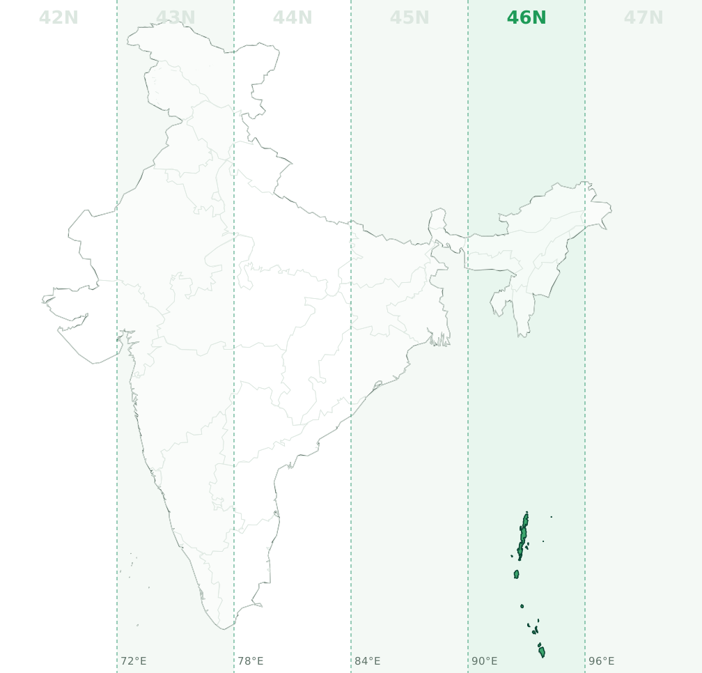
Latitude bands N and P, so a full designation looks like 46P. Example: a point at 10.581°N, 92.574°E converts to 46N 453420 E, 1169641 N on WGS84.
Andhra Pradesh (AP)
Andhra Pradesh is mainly in UTM zone 44N (82.7% of its area, central meridian 81°E, EPSG:32644), with 15.6% in 43N (EPSG:32643) and 1.7% in 45N (EPSG:32645). The zone boundary at 78°E and 84°E runs through the state, so check the longitude of each site: west of 78°E is 43N, between 78°E and 84°E is 44N and east of 84°E is 45N.
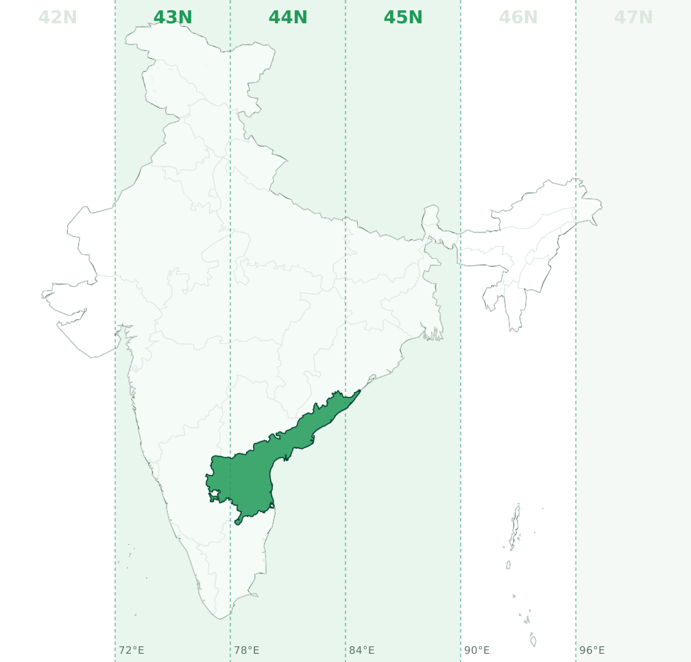
Latitude bands P and Q, so a full designation looks like 44P. Example: a point at 15.815°N, 80.171°E converts to 44N 411233 E, 1748607 N on WGS84.
Arunachal Pradesh (Arunachal)
Arunachal Pradesh is mainly in UTM zone 46N (78% of its area, central meridian 93°E, EPSG:32646), with 22% in 47N (EPSG:32647). The zone boundary at 96°E runs through the state, so check the longitude of each site: between 90°E and 96°E is 46N and east of 96°E is 47N.
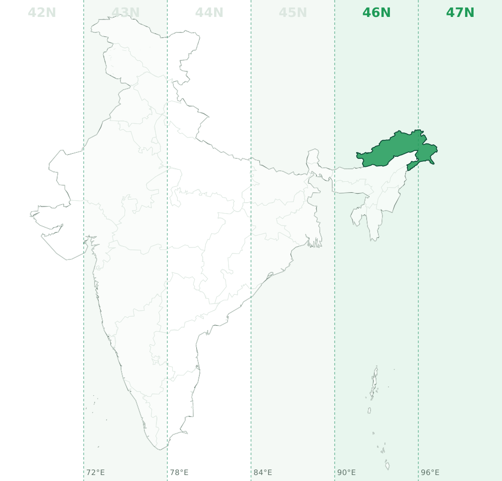
Latitude band R, so a full designation looks like 46R. Example: a point at 28.036°N, 94.661°E converts to 46N 663225 E, 3102291 N on WGS84.
Assam
Assam is mainly in UTM zone 46N (96.9% of its area, central meridian 93°E, EPSG:32646), with 3.1% in 45N (EPSG:32645). The zone boundary at 90°E runs through the state, so check the longitude of each site: west of 90°E is 45N and between 90°E and 96°E is 46N.
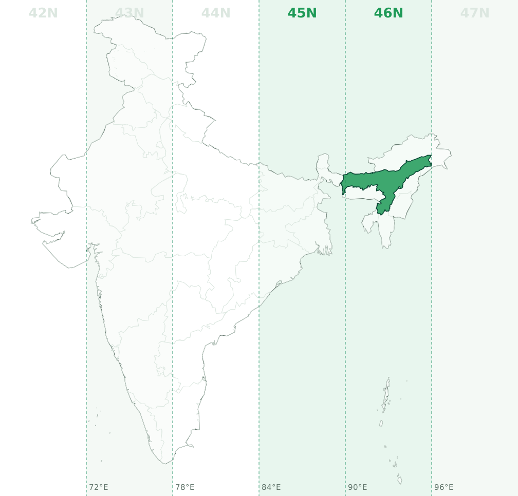
Latitude band R, so a full designation looks like 46R. Example: a point at 26.357°N, 92.831°E converts to 46N 483167 E, 2915224 N on WGS84.
Bihar
Bihar is mainly in UTM zone 45N (93.4% of its area, central meridian 87°E, EPSG:32645), with 6.6% in 44N (EPSG:32644). The zone boundary at 84°E runs through the state, so check the longitude of each site: west of 84°E is 44N and between 84°E and 90°E is 45N.
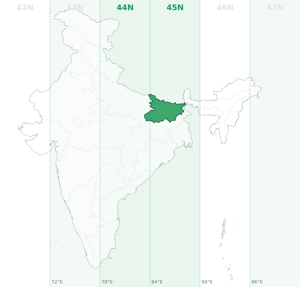
Latitude band R, so a full designation looks like 45R. Example: a point at 25.662°N, 85.604°E converts to 45N 359909 E, 2839004 N on WGS84.
Chandigarh
Chandigarh is entirely in UTM zone 43N (central meridian 75°E, EPSG:32643). No part of the union territory crosses a zone boundary.
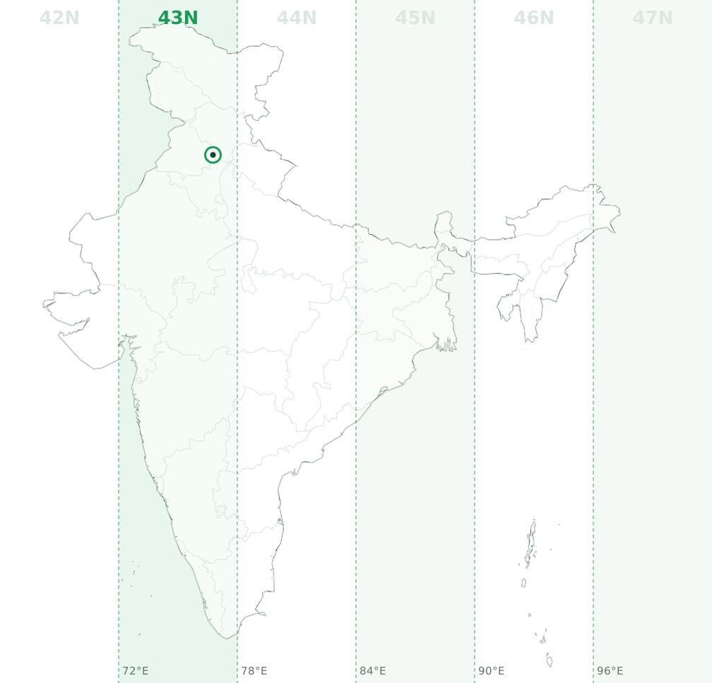
Latitude band R, so a full designation looks like 43R. Example: a point at 30.744°N, 76.768°E converts to 43N 669283 E, 3402515 N on WGS84.
Chhattisgarh (CG)
Chhattisgarh is mainly in UTM zone 44N (99% of its area, central meridian 81°E, EPSG:32644), with 1% in 45N (EPSG:32645). The zone boundary at 84°E runs through the state, so check the longitude of each site: between 78°E and 84°E is 44N and east of 84°E is 45N.
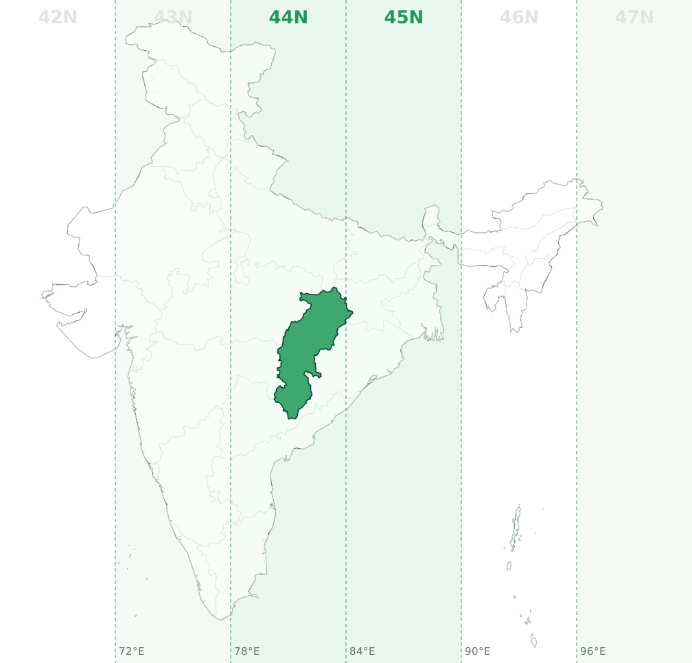
Latitude bands Q and R, so a full designation looks like 44Q. Example: a point at 21.256°N, 82.033°E converts to 44N 607217 E, 2350820 N on WGS84.
Dadra and Nagar Haveli and Daman and Diu (DNHDD, Daman and Diu)
Dadra and Nagar Haveli and Daman and Diu is mainly in UTM zone 43N (98.6% of its area, central meridian 75°E, EPSG:32643), with 1.4% in 42N (EPSG:32642). The zone boundary at 72°E runs through the union territory, so check the longitude of each site: west of 72°E is 42N and between 72°E and 78°E is 43N.
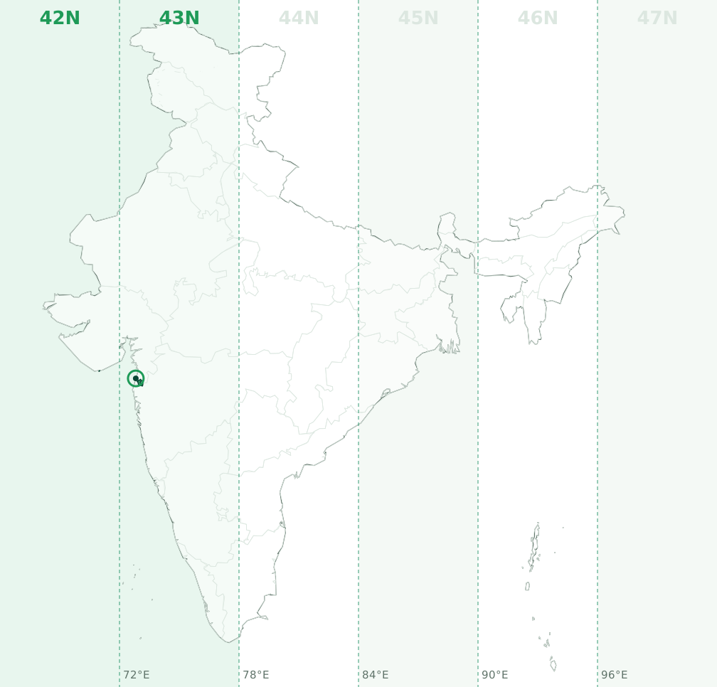
Latitude band Q, so a full designation looks like 43Q. Example: a point at 20.379°N, 72.818°E converts to 43N 272272 E, 2254907 N on WGS84.
Delhi (NCT, New Delhi)
Delhi is entirely in UTM zone 43N (central meridian 75°E, EPSG:32643). No part of the union territory crosses a zone boundary.
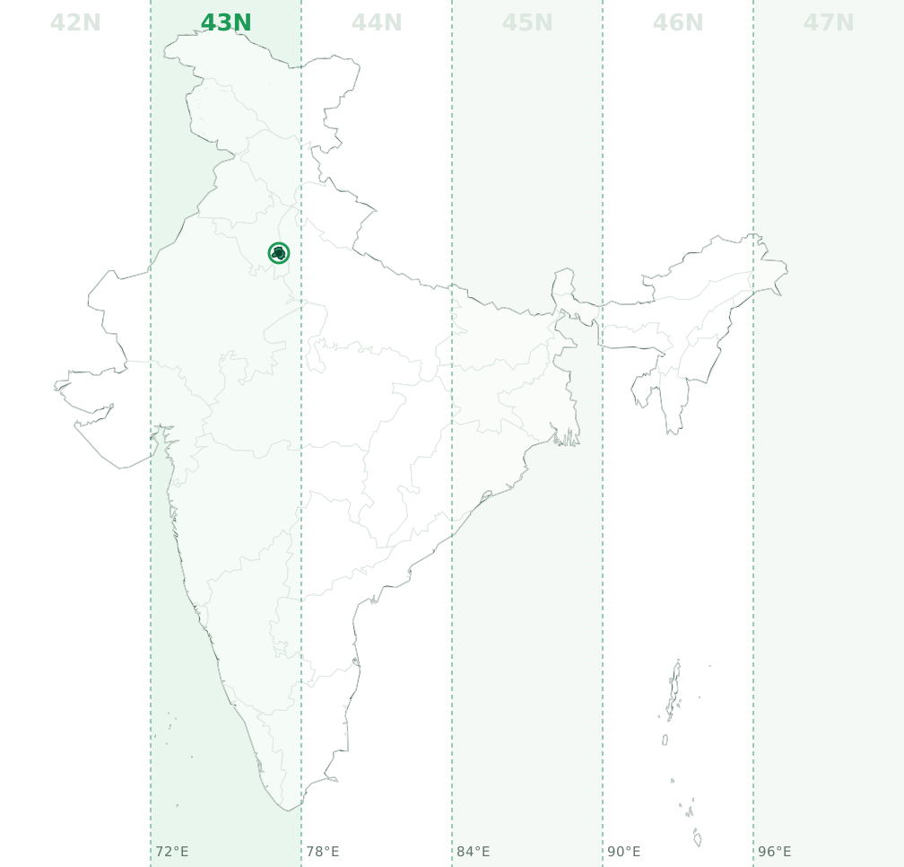
Latitude band R, so a full designation looks like 43R. Example: a point at 28.661°N, 77.108°E converts to 43N 706006 E, 3172231 N on WGS84.
Goa
Goa is entirely in UTM zone 43N (central meridian 75°E, EPSG:32643). No part of the state crosses a zone boundary.
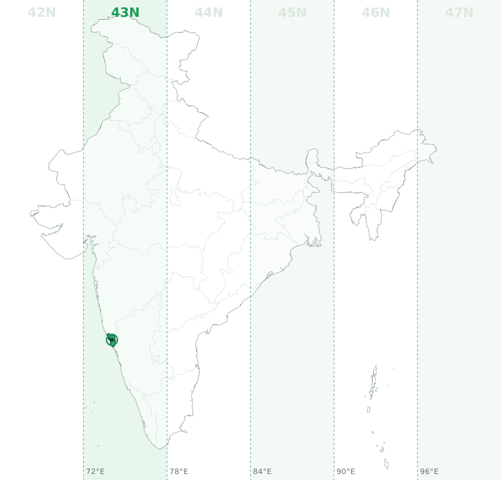
Latitude band P, so a full designation looks like 43P. Example: a point at 15.352°N, 74.046°E converts to 43N 397585 E, 1697507 N on WGS84.
Gujarat (GJ)
Gujarat is mainly in UTM zone 42N (60% of its area, central meridian 69°E, EPSG:32642), with 40% in 43N (EPSG:32643). The zone boundary at 72°E runs through the state, so check the longitude of each site: between 66°E and 72°E is 42N and east of 72°E is 43N.
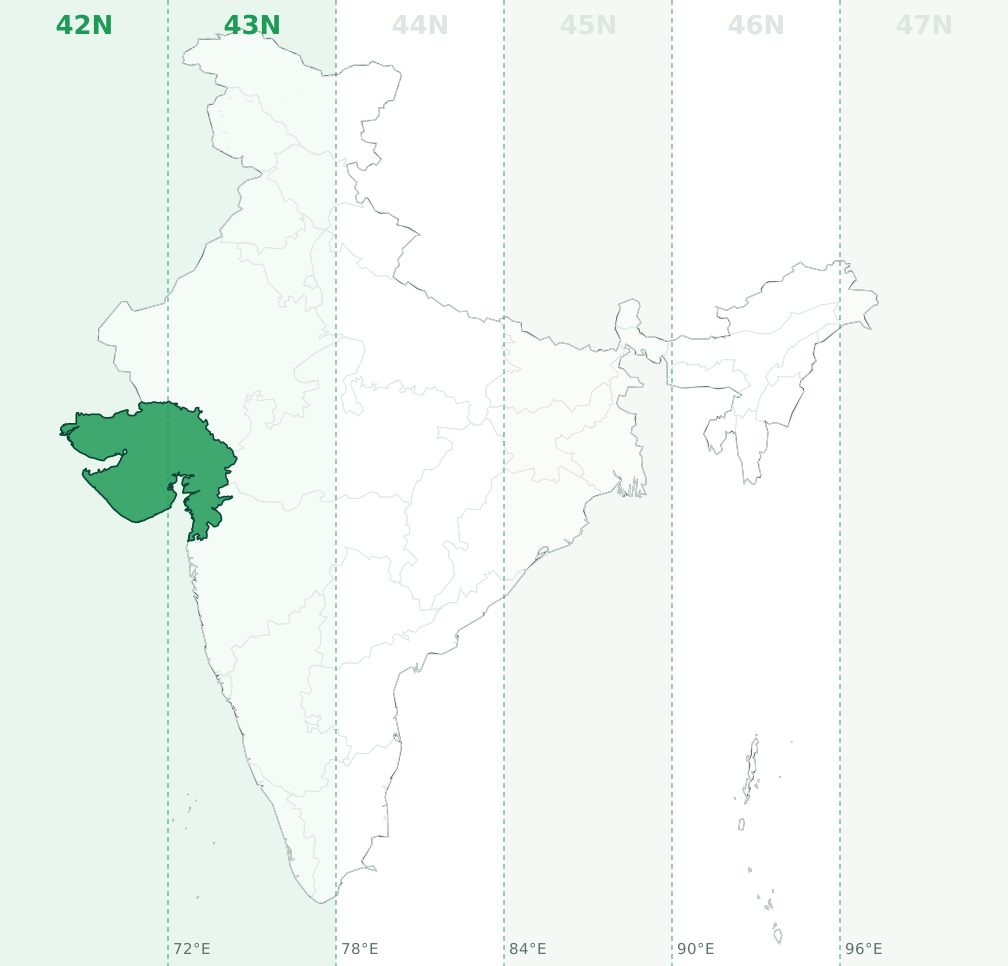
Latitude bands Q and R, so a full designation looks like 42Q. Example: a point at 22.713°N, 71.558°E converts to 42N 762778 E, 2513997 N on WGS84.
Haryana (HR)
Haryana is entirely in UTM zone 43N (central meridian 75°E, EPSG:32643). No part of the state crosses a zone boundary.
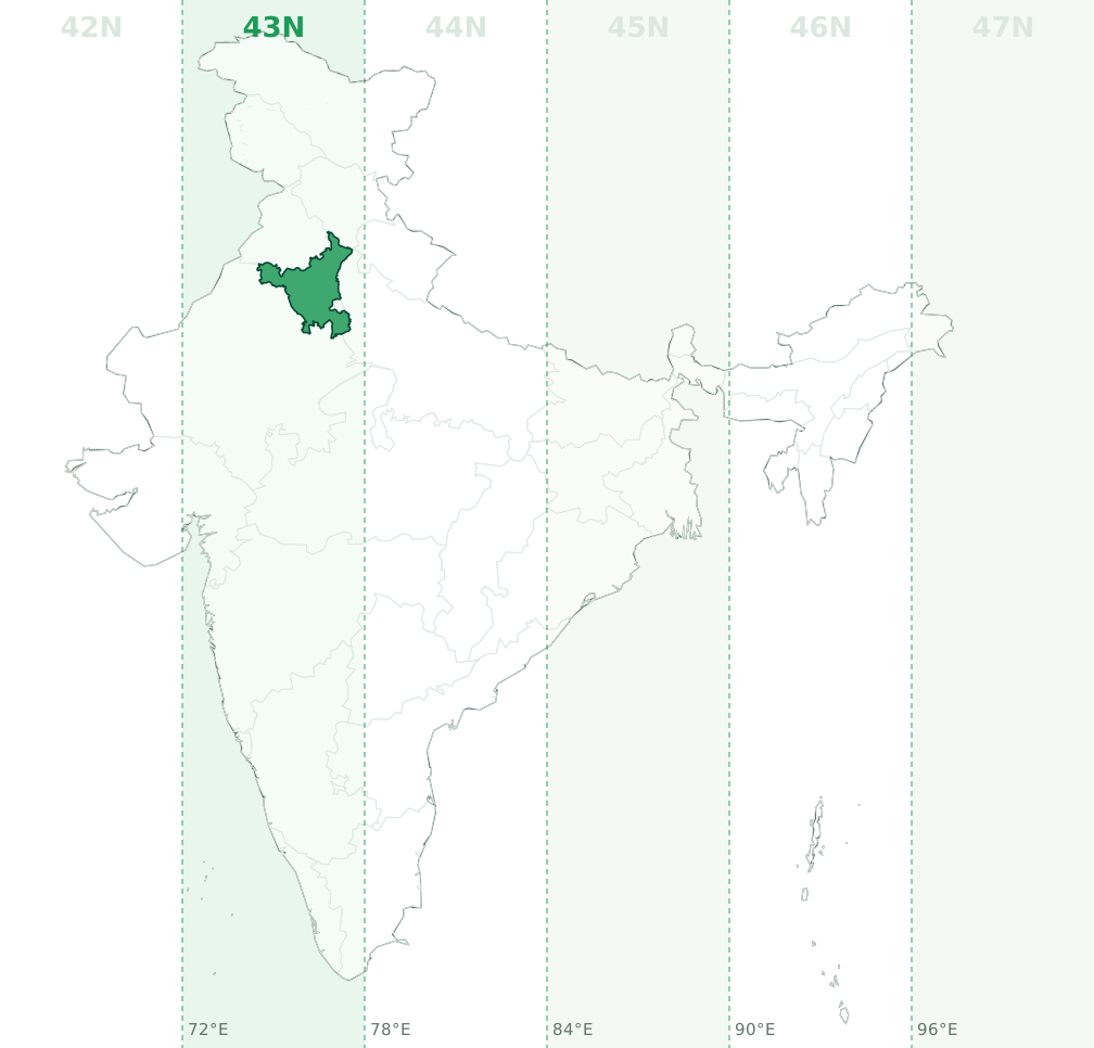
Latitude band R, so a full designation looks like 43R. Example: a point at 29.208°N, 76.336°E converts to 43N 629916 E, 3231811 N on WGS84.
Himachal Pradesh (HP, Himachal)
Himachal Pradesh is mainly in UTM zone 43N (82.9% of its area, central meridian 75°E, EPSG:32643), with 17.1% in 44N (EPSG:32644). The zone boundary at 78°E runs through the union territory, so check the longitude of each site: between 72°E and 78°E is 43N and east of 78°E is 44N.
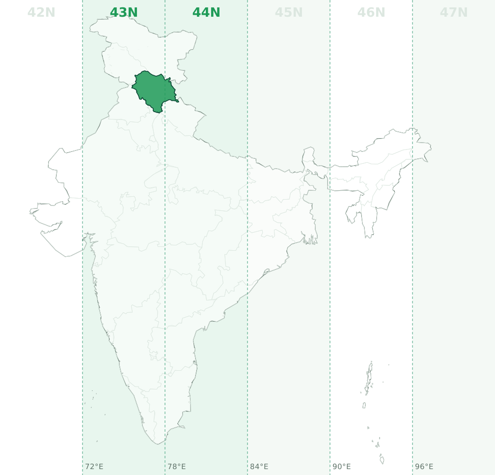
Latitude bands R and S, so a full designation looks like 43R. Example: a point at 31.936°N, 77.221°E converts to 43N 709939 E, 3535529 N on WGS84.
Jammu and Kashmir (J&K, JK)
Jammu and Kashmir is entirely in UTM zone 43N (central meridian 75°E, EPSG:32643). No part of the union territory crosses a zone boundary.
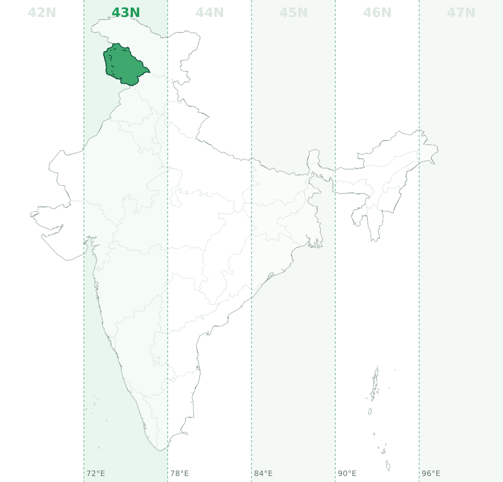
Latitude band S, so a full designation looks like 43S. Example: a point at 33.626°N, 74.884°E converts to 43N 489204 E, 3720742 N on WGS84. Extent as shown on the official map of India, including the area under Pakistani administration.
Jharkhand (JH)
Jharkhand is mainly in UTM zone 45N (93.6% of its area, central meridian 87°E, EPSG:32645), with 6.4% in 44N (EPSG:32644). The zone boundary at 84°E runs through the state, so check the longitude of each site: west of 84°E is 44N and between 84°E and 90°E is 45N.
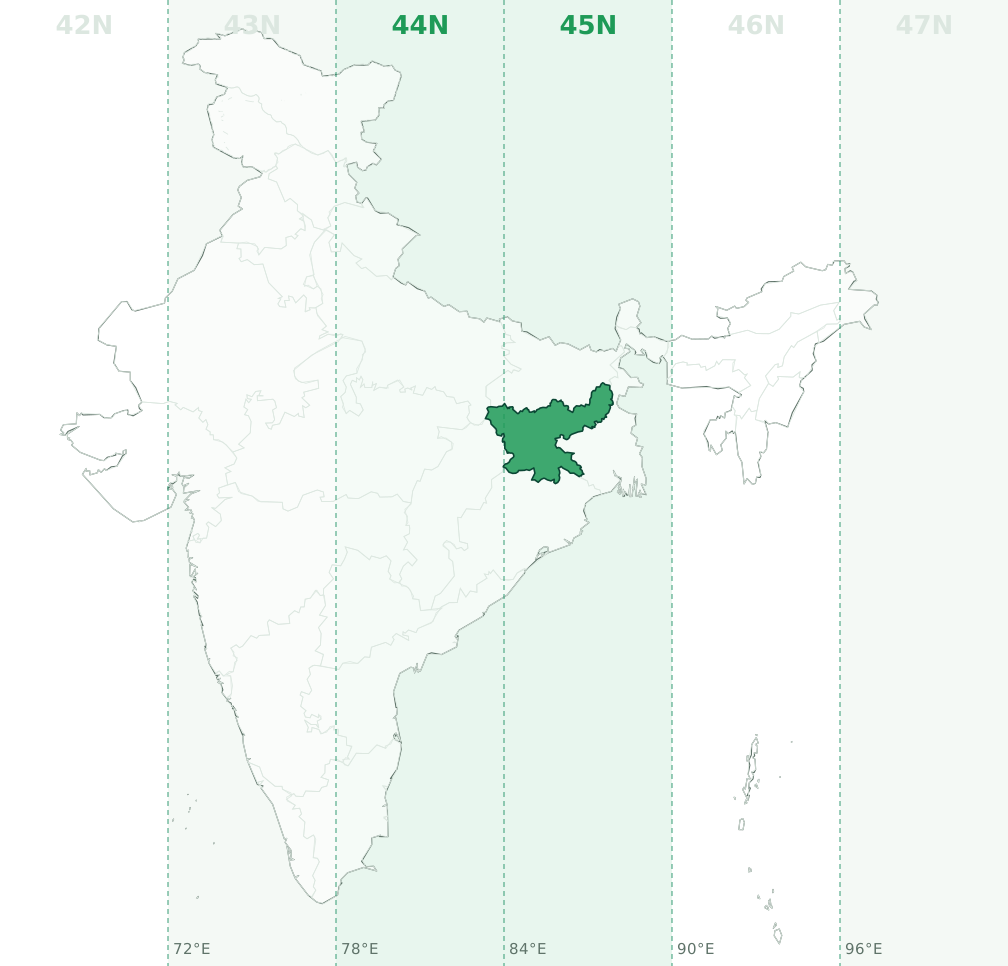
Latitude bands Q and R, so a full designation looks like 45Q. Example: a point at 23.642°N, 85.533°E converts to 45N 350408 E, 2615361 N on WGS84.
Karnataka (KA)
Karnataka is mainly in UTM zone 43N (97.7% of its area, central meridian 75°E, EPSG:32643), with 2.3% in 44N (EPSG:32644). The zone boundary at 78°E runs through the state, so check the longitude of each site: between 72°E and 78°E is 43N and east of 78°E is 44N.
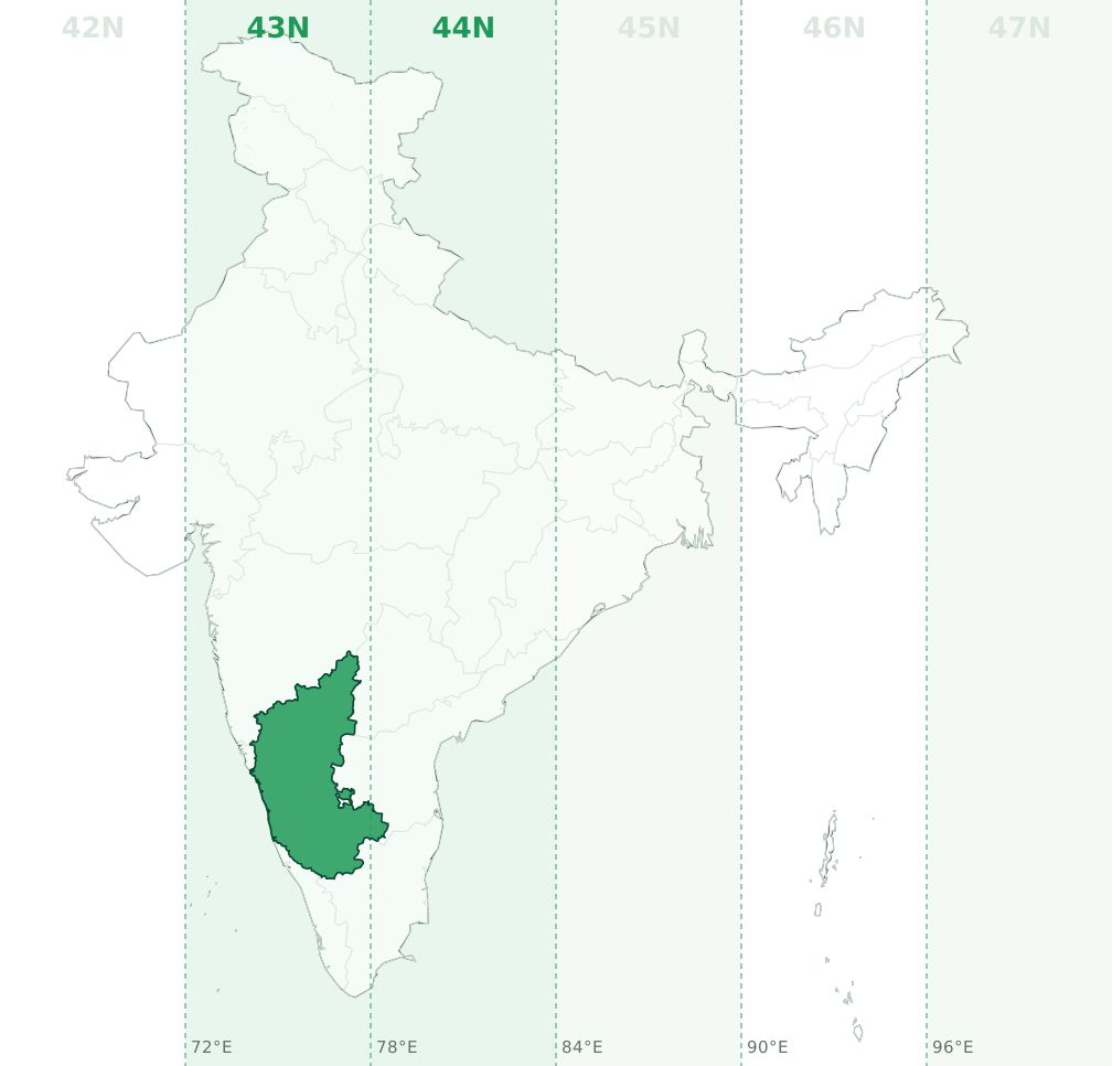
Latitude bands P and Q, so a full designation looks like 43P. Example: a point at 14.72°N, 76.155°E converts to 43N 624357 E, 1627656 N on WGS84.
Kerala (KL)
Kerala is entirely in UTM zone 43N (central meridian 75°E, EPSG:32643). No part of the state crosses a zone boundary.
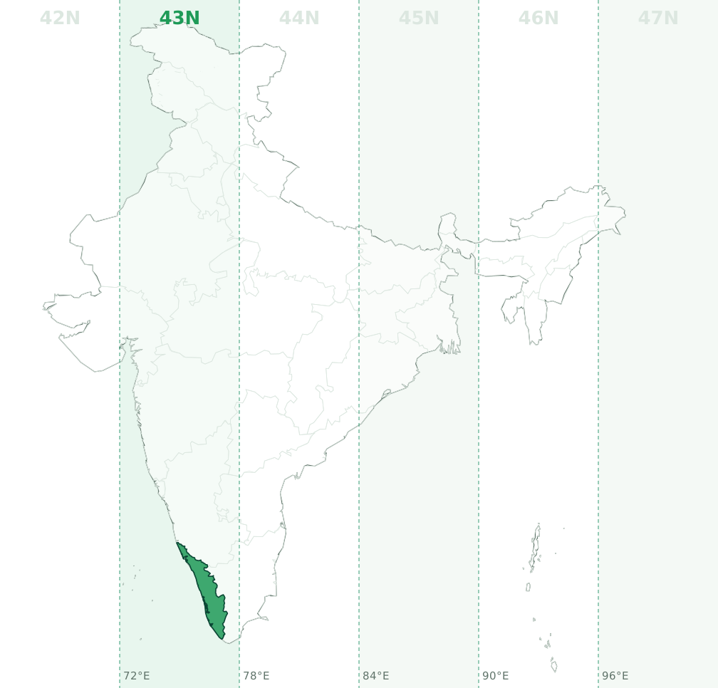
Latitude band P, so a full designation looks like 43P. Example: a point at 10.424°N, 76.425°E converts to 43N 655969 E, 1152622 N on WGS84.
Ladakh
Ladakh is mainly in UTM zone 43N (67.6% of its area, central meridian 75°E, EPSG:32643), with 32.4% in 44N (EPSG:32644). The zone boundary at 78°E runs through the union territory, so check the longitude of each site: between 72°E and 78°E is 43N and east of 78°E is 44N.
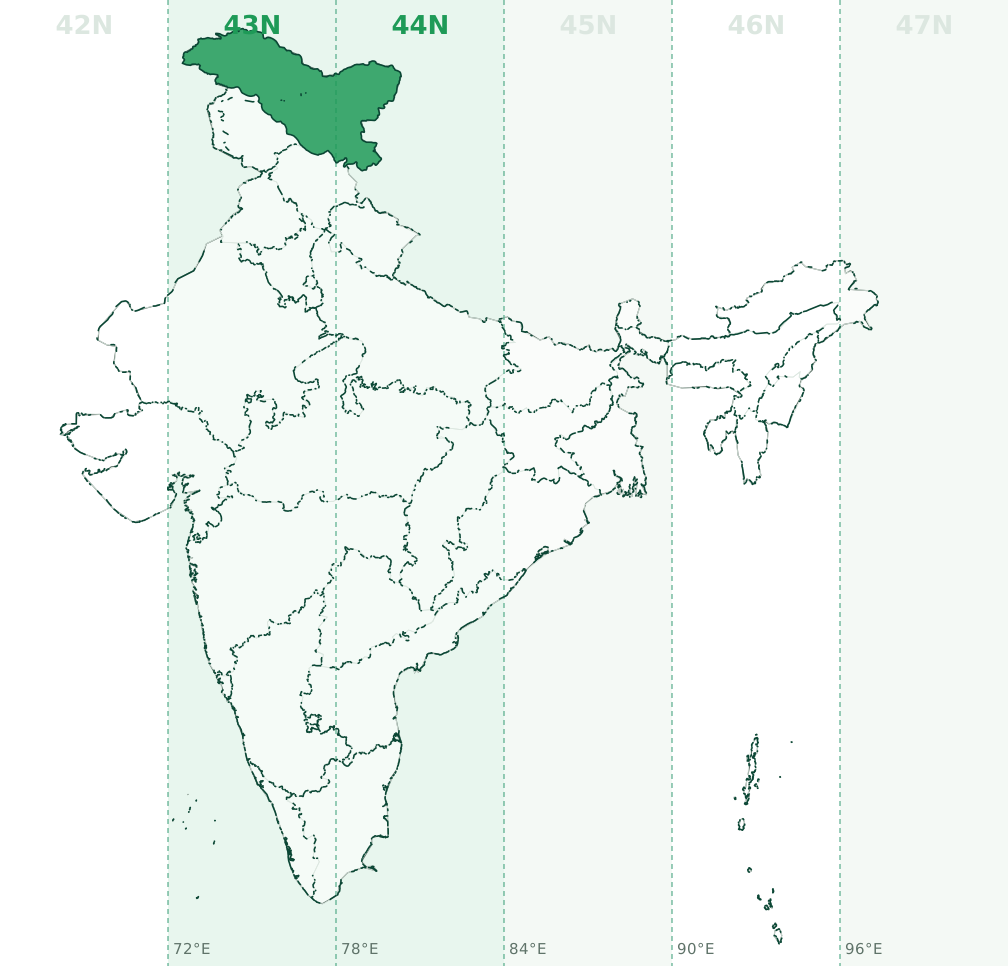
Latitude bands N and S, so a full designation looks like 44Q. Example: a point at 21.56°N, 83.343°E converts to 44N 742662 E, 2385954 N on WGS84. Extent as shown on the official map of India, including Gilgit-Baltistan and Aksai Chin.
Lakshadweep
Lakshadweep is entirely in UTM zone 43N (central meridian 75°E, EPSG:32643). No part of the union territory crosses a zone boundary.
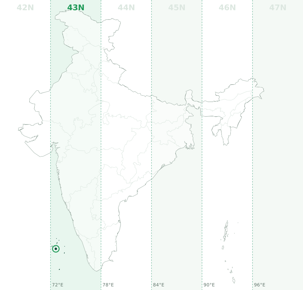
Latitude band P, so a full designation looks like 43P. Example: a point at 10.557°N, 72.633°E converts to 43N 240979 E, 1167928 N on WGS84.
Madhya Pradesh (MP)
Madhya Pradesh is mainly in UTM zone 44N (53.9% of its area, central meridian 81°E, EPSG:32644), with 46.1% in 43N (EPSG:32643). The zone boundary at 78°E runs through the state, so check the longitude of each site: west of 78°E is 43N and between 78°E and 84°E is 44N.
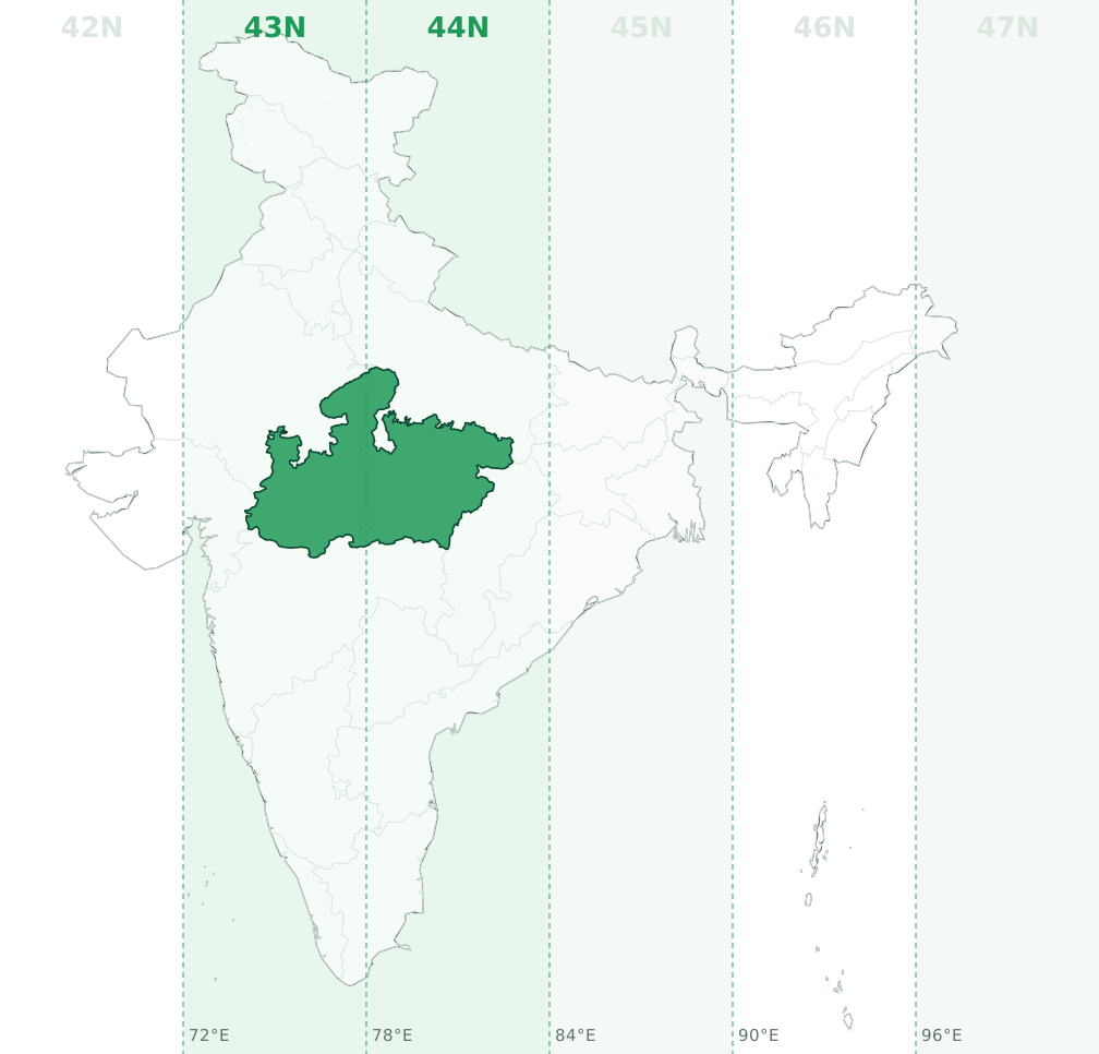
Latitude bands Q and R, so a full designation looks like 44Q. Example: a point at 23.539°N, 78.293°E converts to 44N 223603 E, 2605808 N on WGS84.
Maharashtra (MH)
Maharashtra is mainly in UTM zone 43N (79.3% of its area, central meridian 75°E, EPSG:32643), with 20.7% in 44N (EPSG:32644). The zone boundary at 78°E runs through the state, so check the longitude of each site: between 72°E and 78°E is 43N and east of 78°E is 44N.
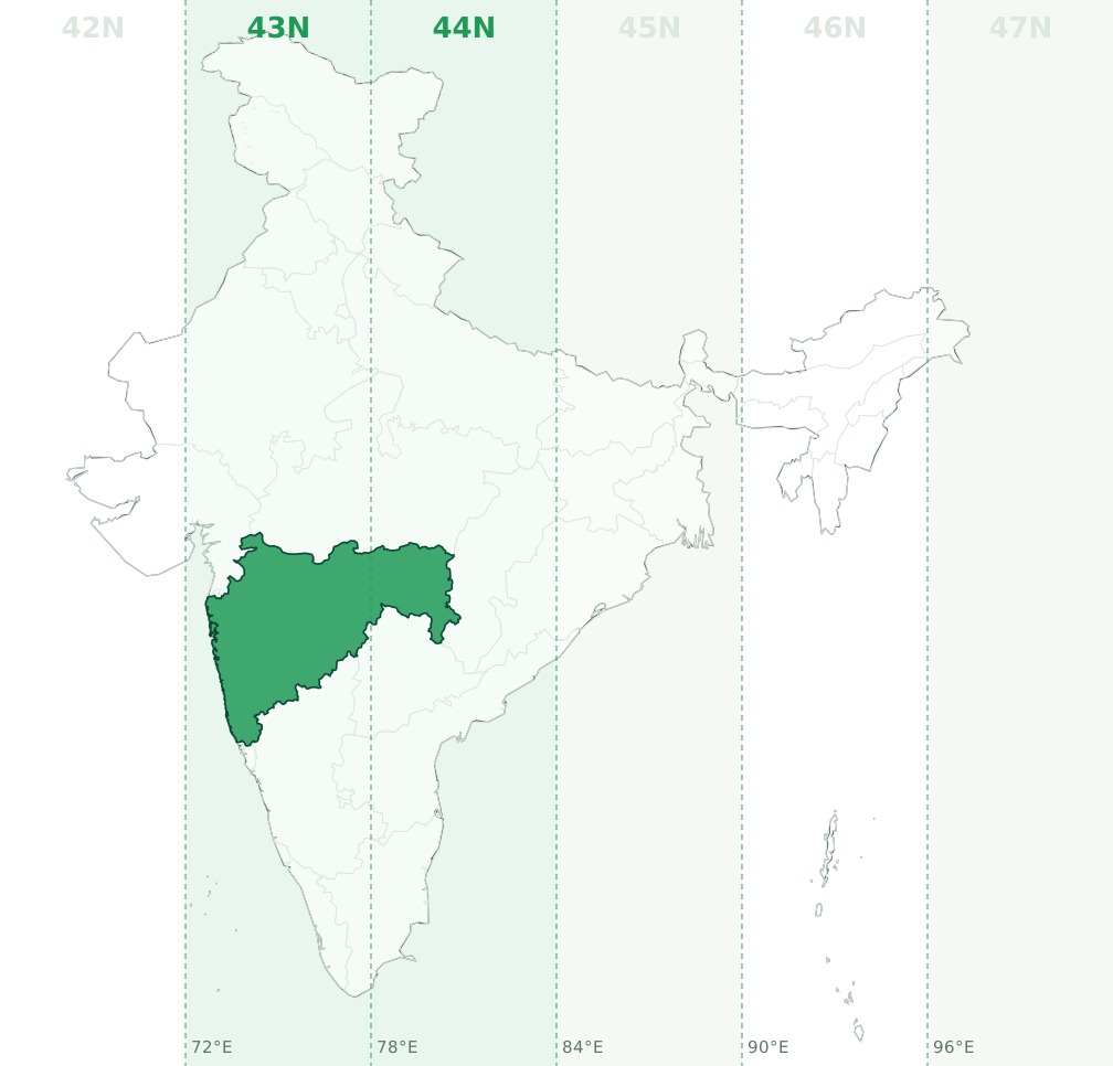
Latitude bands P and Q, so a full designation looks like 43Q. Example: a point at 19.46°N, 76.111°E converts to 43N 616649 E, 2152154 N on WGS84.
Manipur
Manipur is entirely in UTM zone 46N (central meridian 93°E, EPSG:32646). No part of the state crosses a zone boundary.
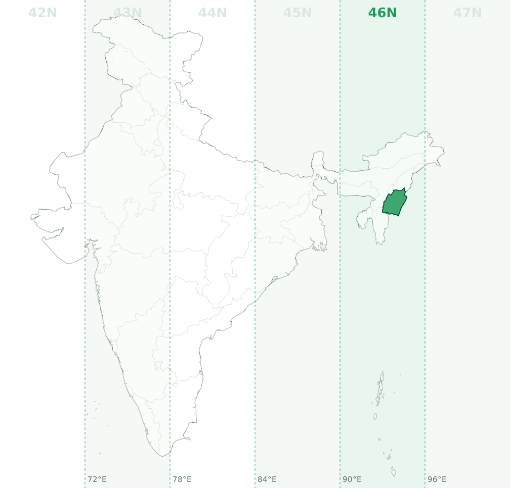
Latitude bands Q and R, so a full designation looks like 46R. Example: a point at 24.73°N, 93.862°E converts to 46N 587134 E, 2735369 N on WGS84.
Meghalaya
Meghalaya is mainly in UTM zone 46N (97.4% of its area, central meridian 93°E, EPSG:32646), with 2.6% in 45N (EPSG:32645). The zone boundary at 90°E runs through the state, so check the longitude of each site: west of 90°E is 45N and between 90°E and 96°E is 46N.
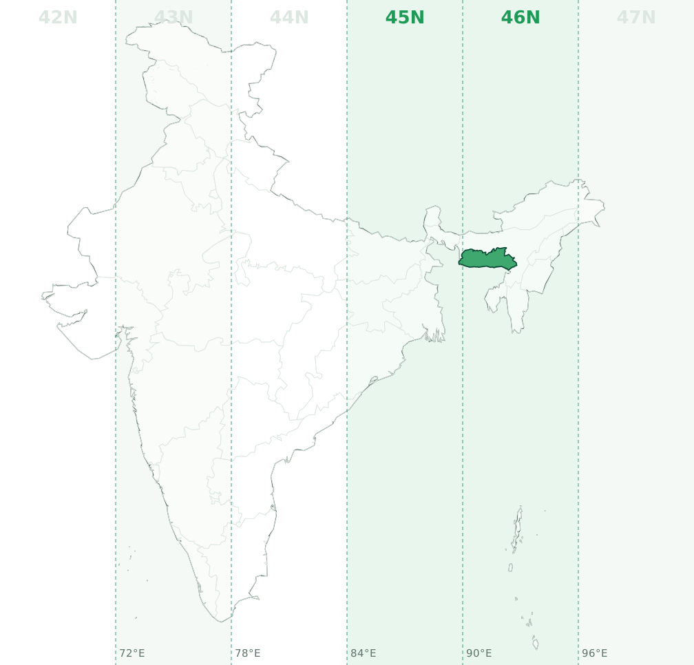
Latitude band R, so a full designation looks like 46R. Example: a point at 25.536°N, 91.287°E converts to 46N 327887 E, 2825423 N on WGS84.
Mizoram
Mizoram is entirely in UTM zone 46N (central meridian 93°E, EPSG:32646). No part of the state crosses a zone boundary.
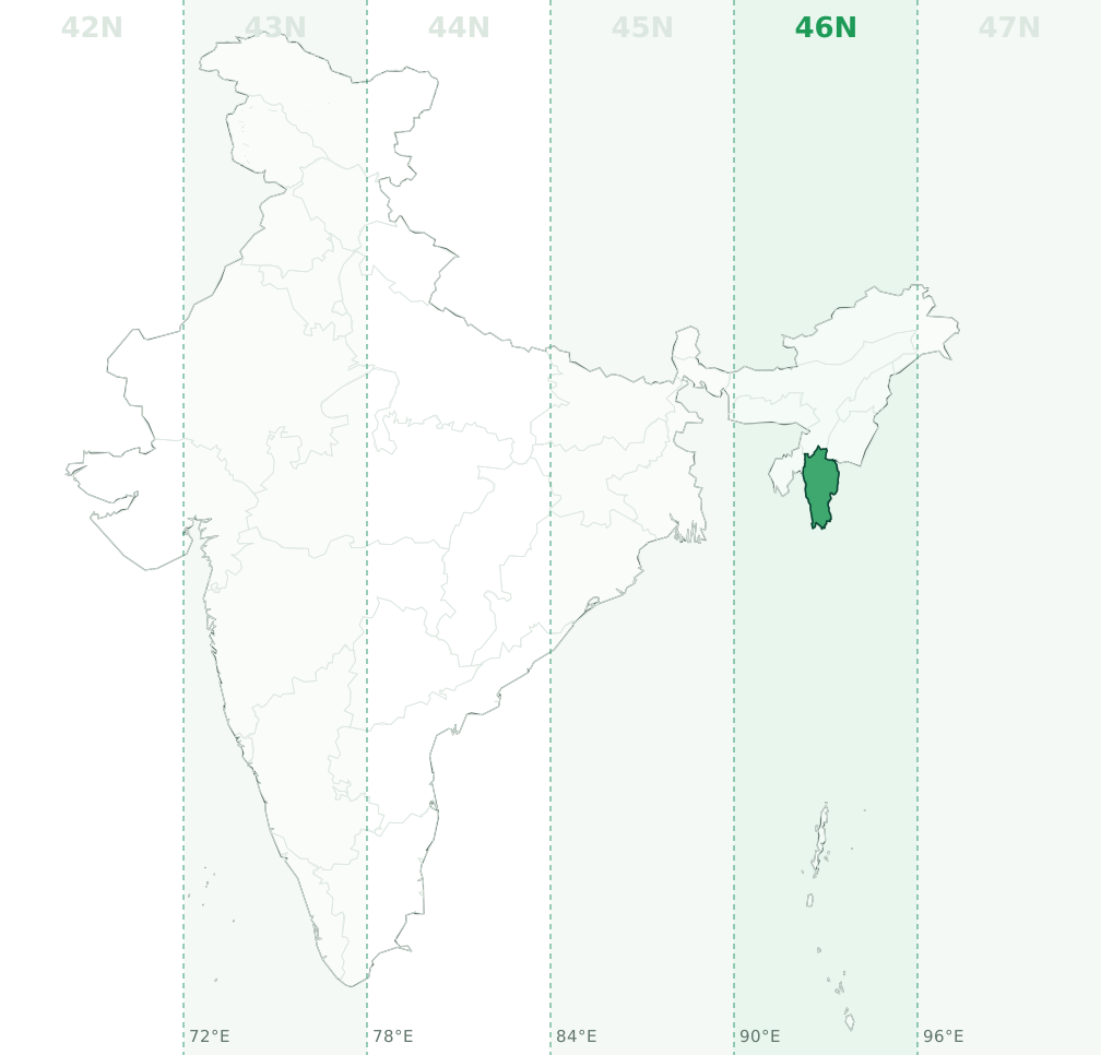
Latitude bands Q and R, so a full designation looks like 46Q. Example: a point at 23.292°N, 92.819°E converts to 46N 481505 E, 2575860 N on WGS84.
Nagaland
Nagaland is entirely in UTM zone 46N (central meridian 93°E, EPSG:32646). No part of the state crosses a zone boundary.
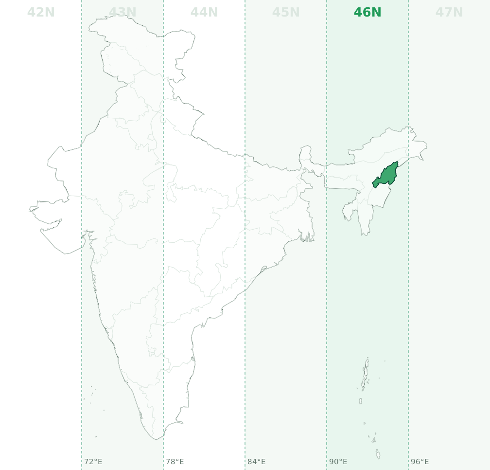
Latitude band R, so a full designation looks like 46R. Example: a point at 26.06°N, 94.448°E converts to 46N 644889 E, 2883113 N on WGS84.
Odisha (Orissa)
Odisha is mainly in UTM zone 45N (59.6% of its area, central meridian 87°E, EPSG:32645), with 40.4% in 44N (EPSG:32644). The zone boundary at 84°E runs through the state, so check the longitude of each site: west of 84°E is 44N and between 84°E and 90°E is 45N.
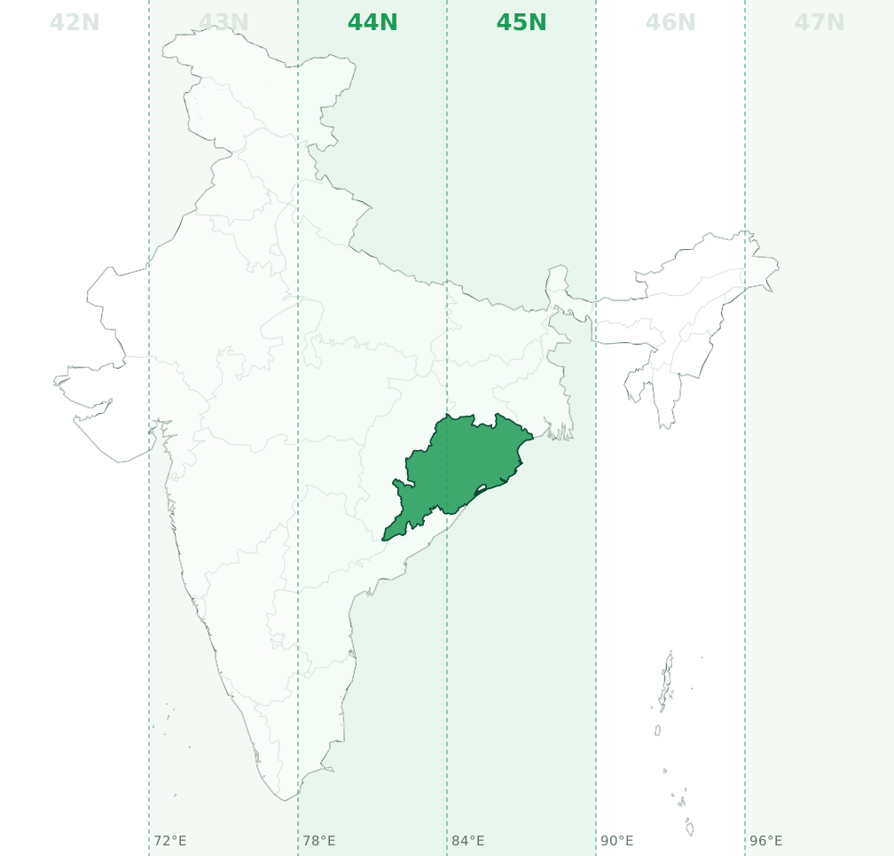
Latitude band Q, so a full designation looks like 45Q. Example: a point at 20.517°N, 84.415°E converts to 45N 230372 E, 2270840 N on WGS84.
Puducherry (Pondicherry)
Puducherry is mainly in UTM zone 44N (76.3% of its area, central meridian 81°E, EPSG:32644), with 23.7% in 43N (EPSG:32643). The zone boundary at 78°E runs through the union territory, so check the longitude of each site: west of 78°E is 43N and between 78°E and 84°E is 44N.
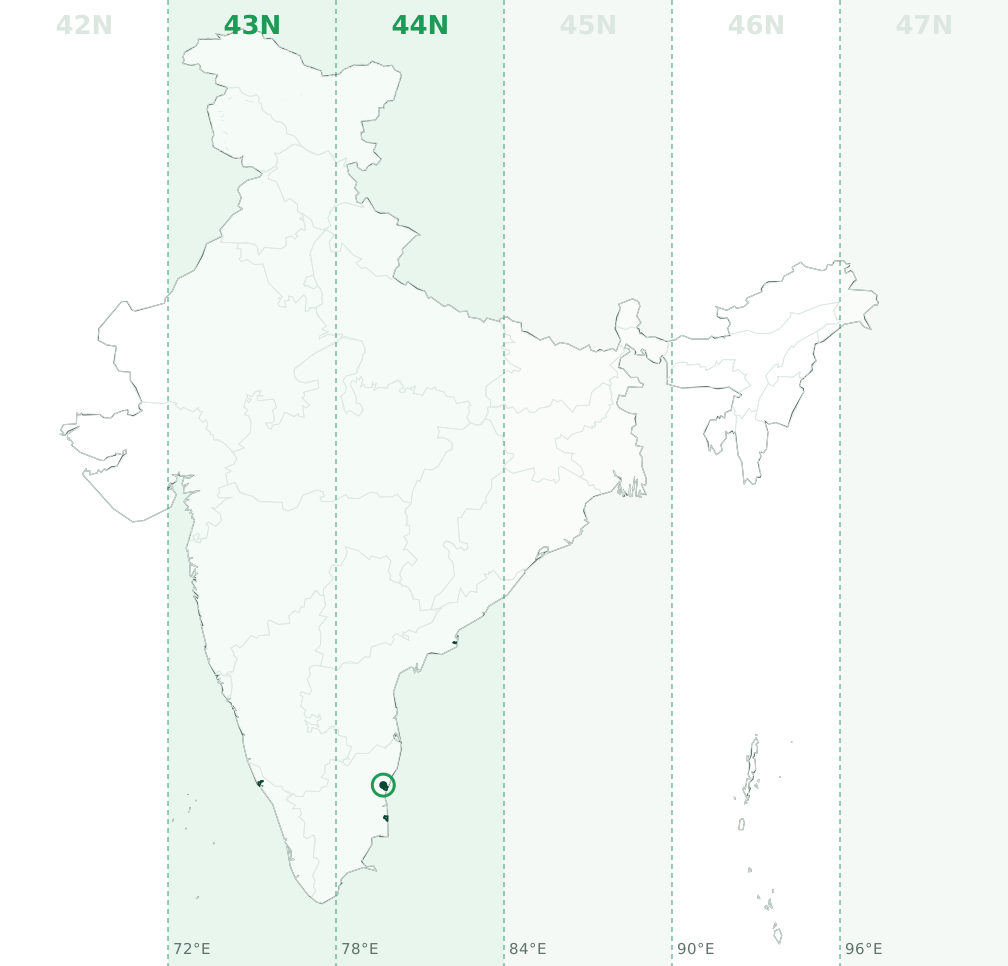
Latitude bands P and Q, so a full designation looks like 44P. Example: a point at 12.001°N, 79.688°E converts to 44N 357176 E, 1327044 N on WGS84.
Punjab (PB)
Punjab is entirely in UTM zone 43N (central meridian 75°E, EPSG:32643). No part of the state crosses a zone boundary.
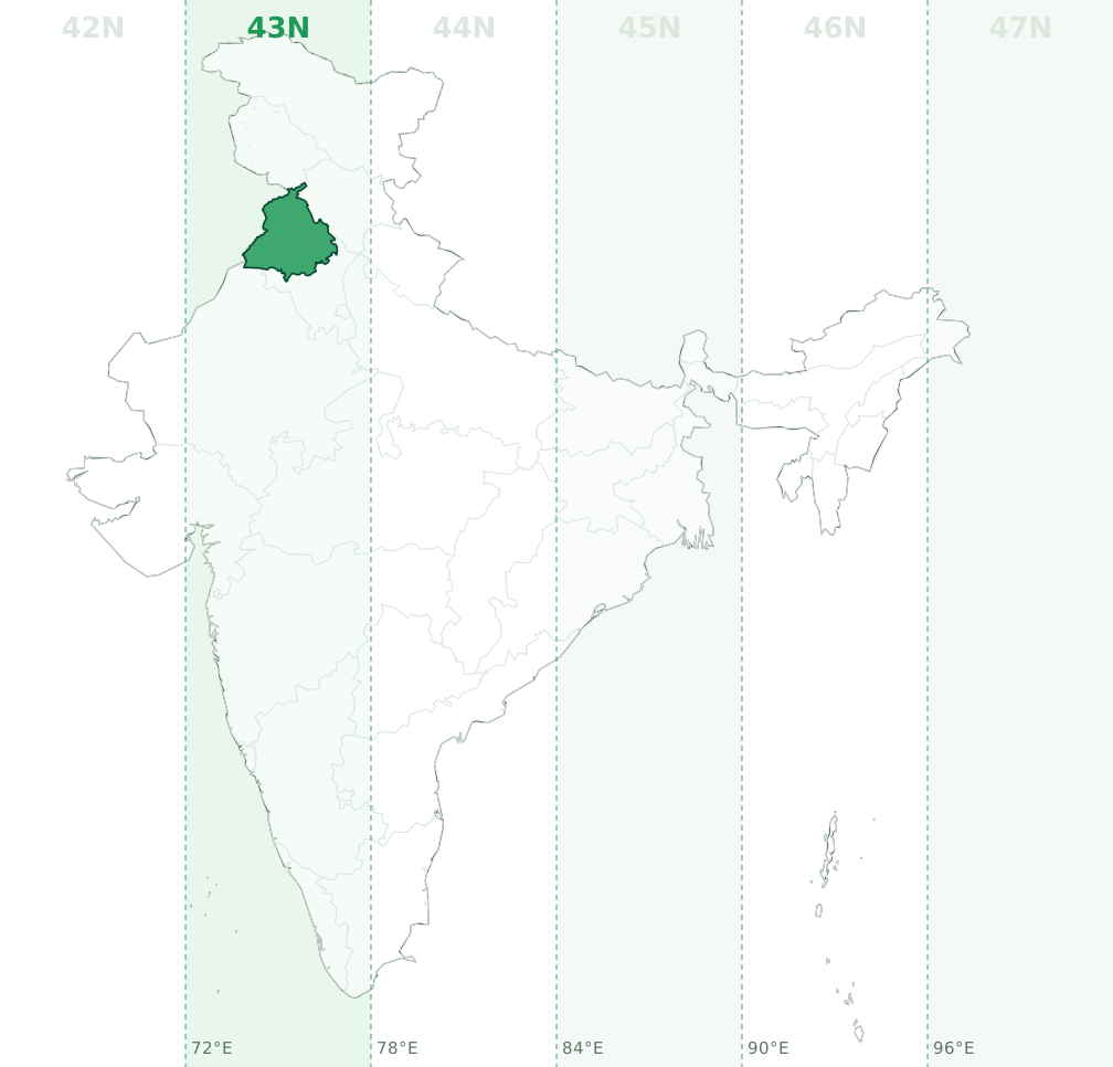
Latitude bands R and S, so a full designation looks like 43R. Example: a point at 30.848°N, 75.404°E converts to 43N 538663 E, 3412859 N on WGS84.
Rajasthan (RJ)
Rajasthan is mainly in UTM zone 43N (81.1% of its area, central meridian 75°E, EPSG:32643), with 18.7% in 42N (EPSG:32642). The zone boundary at 72°E runs through the state, so check the longitude of each site: west of 72°E is 42N and between 72°E and 78°E is 43N.
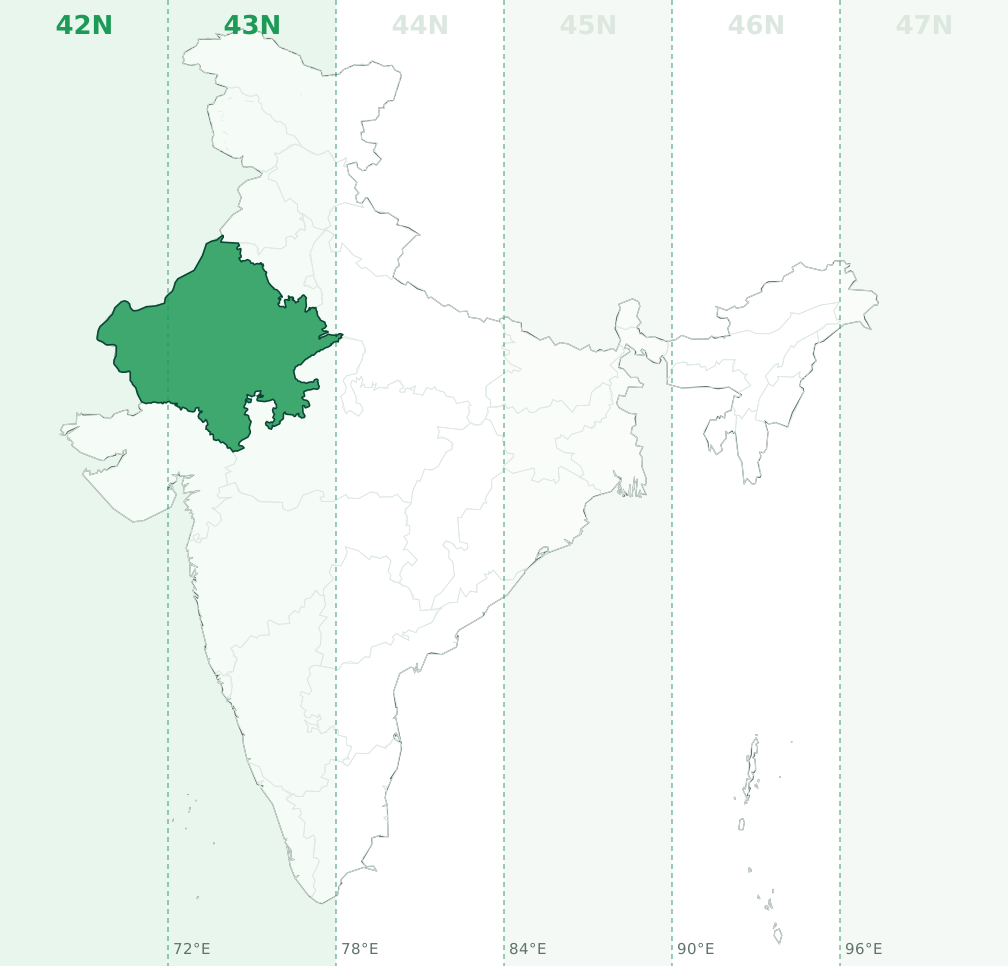
Latitude bands Q and R, so a full designation looks like 43R. Example: a point at 26.593°N, 73.834°E converts to 43N 383921 E, 2941854 N on WGS84.
Sikkim
Sikkim is entirely in UTM zone 45N (central meridian 87°E, EPSG:32645). No part of the state crosses a zone boundary.
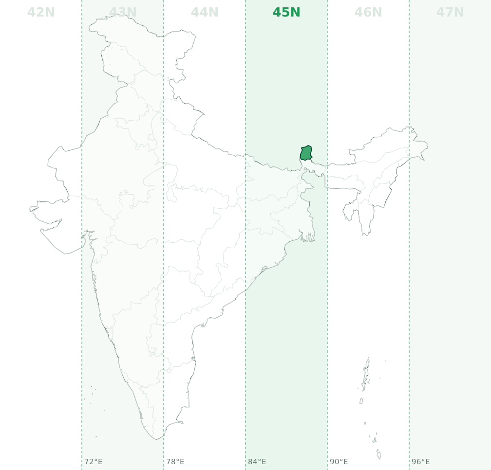
Latitude band R, so a full designation looks like 45R. Example: a point at 27.572°N, 88.448°E converts to 45N 642955 E, 3050631 N on WGS84.
Tamil Nadu (TN)
Tamil Nadu is mainly in UTM zone 44N (63% of its area, central meridian 81°E, EPSG:32644), with 37% in 43N (EPSG:32643). The zone boundary at 78°E runs through the state, so check the longitude of each site: west of 78°E is 43N and between 78°E and 84°E is 44N.
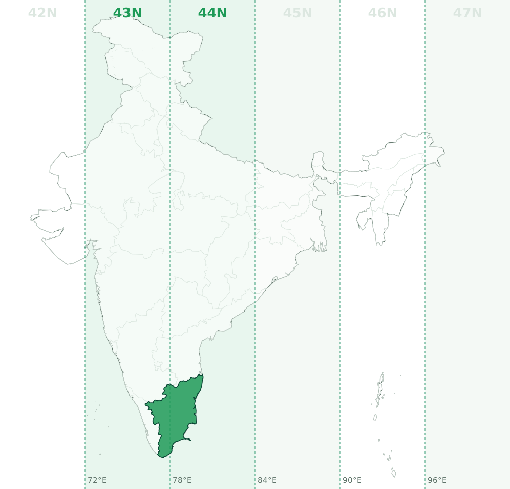
Latitude band P, so a full designation looks like 44P. Example: a point at 10.915°N, 78.336°E converts to 44N 208793 E, 1207910 N on WGS84.
Telangana (TS, TG)
Telangana is mainly in UTM zone 44N (84.6% of its area, central meridian 81°E, EPSG:32644), with 15.4% in 43N (EPSG:32643). The zone boundary at 78°E runs through the state, so check the longitude of each site: west of 78°E is 43N and between 78°E and 84°E is 44N.
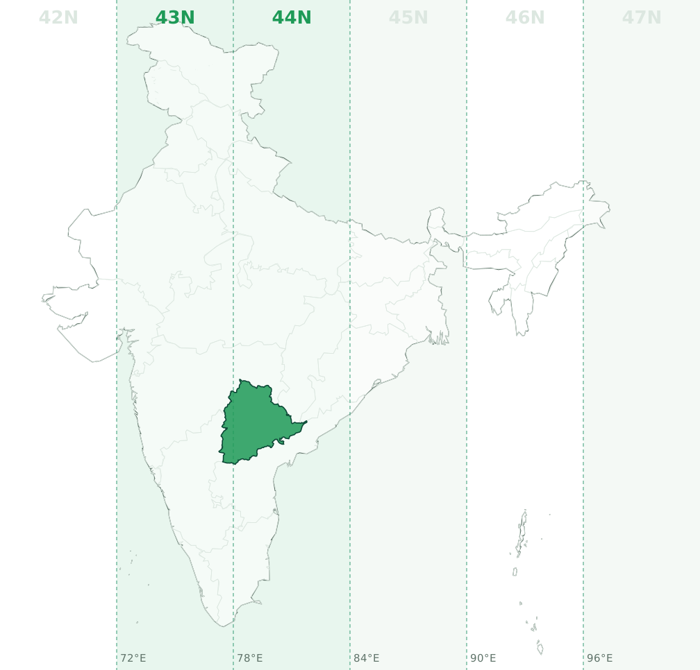
Latitude bands P and Q, so a full designation looks like 44Q. Example: a point at 17.797°N, 79.051°E converts to 44N 293381 E, 1968762 N on WGS84.
Tripura
Tripura is entirely in UTM zone 46N (central meridian 93°E, EPSG:32646). No part of the state crosses a zone boundary.
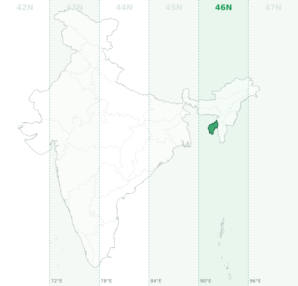
Latitude bands Q and R, so a full designation looks like 46Q. Example: a point at 23.755°N, 91.729°E converts to 46N 370427 E, 2627654 N on WGS84.
Uttar Pradesh (UP)
Uttar Pradesh is mainly in UTM zone 44N (89% of its area, central meridian 81°E, EPSG:32644), with 9.7% in 43N (EPSG:32643) and 1.3% in 45N (EPSG:32645). The zone boundary at 78°E and 84°E runs through the state, so check the longitude of each site: west of 78°E is 43N, between 78°E and 84°E is 44N and east of 84°E is 45N.
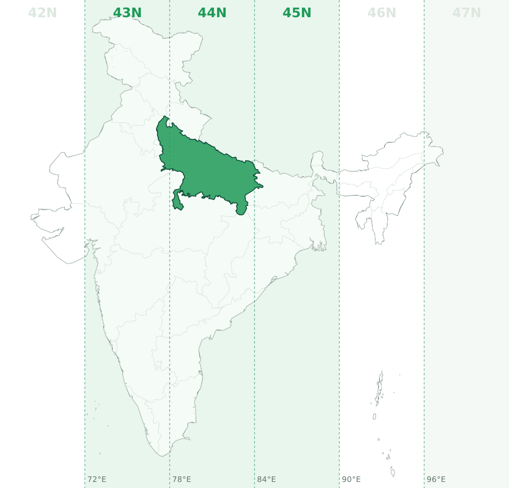
Latitude bands Q and R, so a full designation looks like 44R. Example: a point at 26.935°N, 80.542°E converts to 44N 454525 E, 2979289 N on WGS84.
Uttarakhand (UK, Uttaranchal)
Uttarakhand is mainly in UTM zone 44N (93.4% of its area, central meridian 81°E, EPSG:32644), with 6.6% in 43N (EPSG:32643). The zone boundary at 78°E runs through the state, so check the longitude of each site: west of 78°E is 43N and between 78°E and 84°E is 44N.
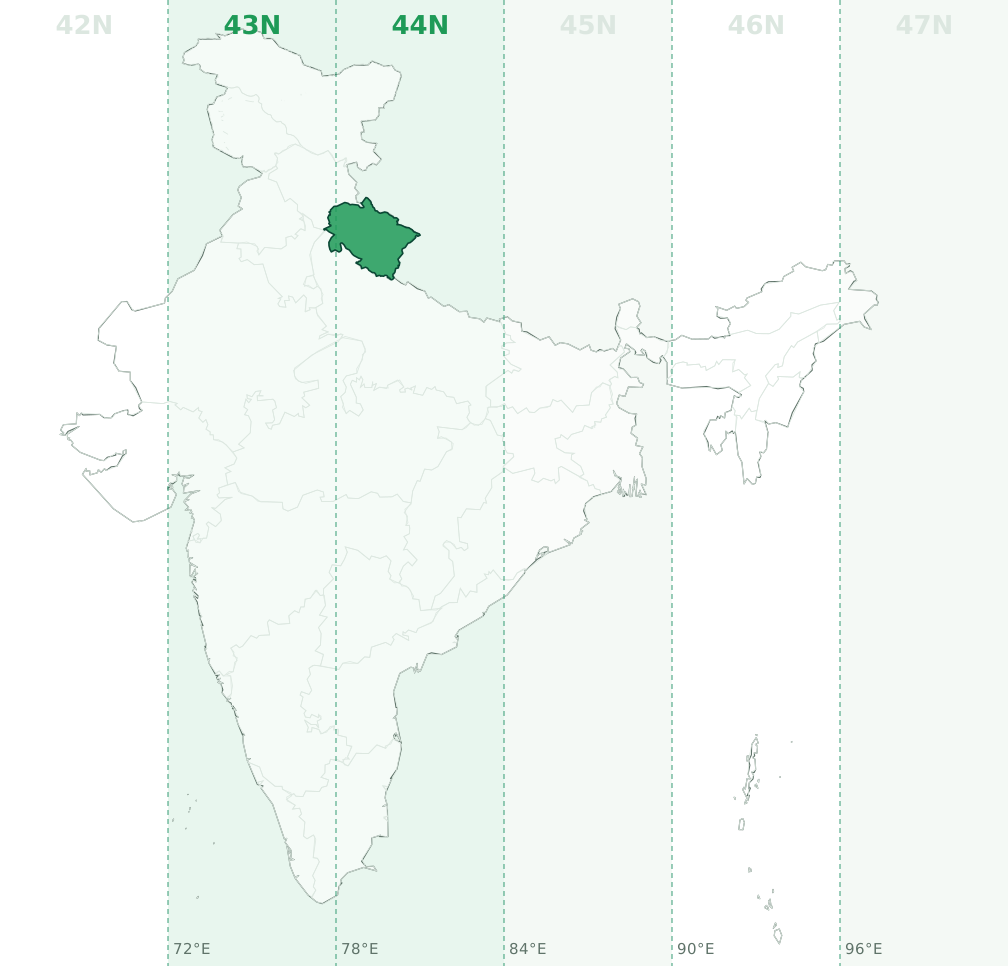
Latitude band R, so a full designation looks like 44R. Example: a point at 30.164°N, 79.196°E converts to 44N 326292 E, 3338301 N on WGS84.
West Bengal (WB)
West Bengal is entirely in UTM zone 45N (central meridian 87°E, EPSG:32645). No part of the state crosses a zone boundary.
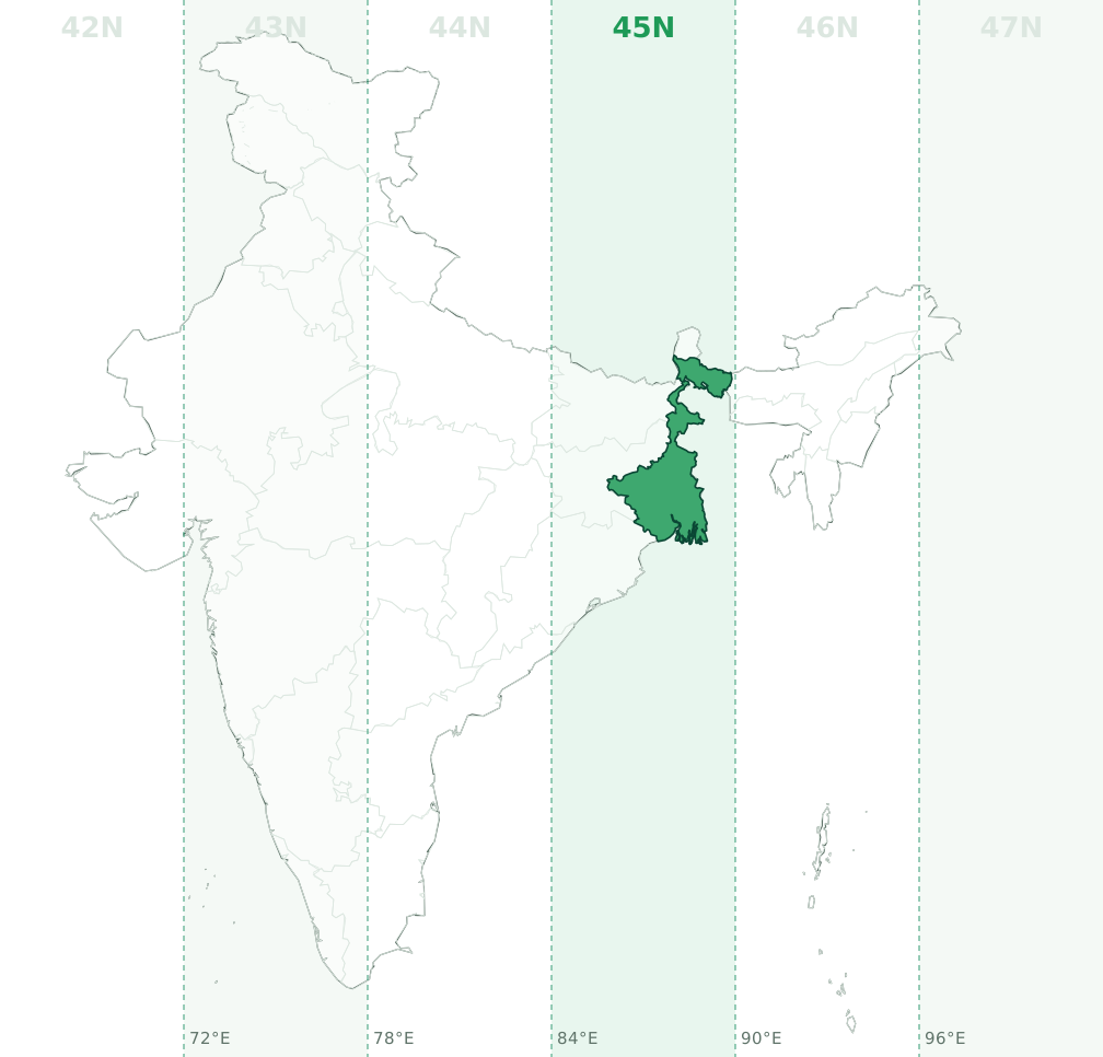
Latitude bands Q and R, so a full designation looks like 45R. Example: a point at 24.255°N, 88.06°E converts to 45N 607634 E, 2682922 N on WGS84.
How to read these maps
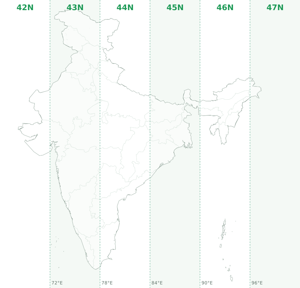
Each map shows the six zones as vertical strips, with the state highlighted and its zones tinted. Zone boundaries fall on the meridians at 72°E, 78°E, 84°E, 90°E and 96°E; the central meridian of each zone is 3° inside its western edge (69, 75, 81, 87, 93 and 99°E). Zone shares are the fraction of the state's land area in each strip, computed from Natural Earth's 1:10 million boundaries following the official map of India. Small territories carry a location marker because they are too small to see at this scale.
When a state is split
A project inside a split state is not automatically split: what matters is the longitude of the site. A wind farm entirely west of 78°E in Madhya Pradesh is a plain zone 43N job. Only a site that itself straddles the meridian needs a decision, and the usual one is to project the whole site into the zone that holds most of it. The reference post covers both options.
Planning a wind or solar layout?
Once your coordinates are in the right zone, reneGIS Windmill Micrositing audits every turbine and solar boundary against competing projects for spacing, wake and boundary conflicts, and exports the result to Google Earth. New organisations start with free credits, enough for about 25 assets. Start free.
Frequently asked questions
Which UTM zone is Madhya Pradesh (MP) in?
Madhya Pradesh is mainly in UTM zone 44N (53.9% of its area, central meridian 81°E, EPSG:32644), with 46.1% in 43N (EPSG:32643). The zone boundary at 78°E runs through the state, so check the longitude of each site: west of 78°E is 43N and between 78°E and 84°E is 44N.
Which UTM zone is Uttar Pradesh (UP) in?
Uttar Pradesh is mainly in UTM zone 44N (89% of its area, central meridian 81°E, EPSG:32644), with 9.7% in 43N (EPSG:32643) and 1.3% in 45N (EPSG:32645). The zone boundary at 78°E and 84°E runs through the state, so check the longitude of each site: west of 78°E is 43N, between 78°E and 84°E is 44N and east of 84°E is 45N.
Which UTM zone is Gujarat (GJ) in?
Gujarat is mainly in UTM zone 42N (60% of its area, central meridian 69°E, EPSG:32642), with 40% in 43N (EPSG:32643). The zone boundary at 72°E runs through the state, so check the longitude of each site: between 66°E and 72°E is 42N and east of 72°E is 43N.
Which UTM zone is Maharashtra (MH) in?
Maharashtra is mainly in UTM zone 43N (79.3% of its area, central meridian 75°E, EPSG:32643), with 20.7% in 44N (EPSG:32644). The zone boundary at 78°E runs through the state, so check the longitude of each site: between 72°E and 78°E is 43N and east of 78°E is 44N.
Which UTM zone is Rajasthan (RJ) in?
Rajasthan is mainly in UTM zone 43N (81.1% of its area, central meridian 75°E, EPSG:32643), with 18.7% in 42N (EPSG:32642). The zone boundary at 72°E runs through the state, so check the longitude of each site: west of 72°E is 42N and between 72°E and 78°E is 43N.
Which UTM zone is Tamil Nadu (TN) in?
Tamil Nadu is mainly in UTM zone 44N (63% of its area, central meridian 81°E, EPSG:32644), with 37% in 43N (EPSG:32643). The zone boundary at 78°E runs through the state, so check the longitude of each site: west of 78°E is 43N and between 78°E and 84°E is 44N.
Which UTM zone is Karnataka (KA) in?
Karnataka is mainly in UTM zone 43N (97.7% of its area, central meridian 75°E, EPSG:32643), with 2.3% in 44N (EPSG:32644). The zone boundary at 78°E runs through the state, so check the longitude of each site: between 72°E and 78°E is 43N and east of 78°E is 44N.
Which UTM zone is Bihar in?
Bihar is mainly in UTM zone 45N (93.4% of its area, central meridian 87°E, EPSG:32645), with 6.6% in 44N (EPSG:32644). The zone boundary at 84°E runs through the state, so check the longitude of each site: west of 84°E is 44N and between 84°E and 90°E is 45N.
Which UTM zone is Kerala (KL) in?
Kerala is entirely in UTM zone 43N (central meridian 75°E, EPSG:32643). No part of the state crosses a zone boundary.
Which UTM zone is Haryana (HR) in?
Haryana is entirely in UTM zone 43N (central meridian 75°E, EPSG:32643). No part of the state crosses a zone boundary.
Which UTM zone is Telangana (TS) in?
Telangana is mainly in UTM zone 44N (84.6% of its area, central meridian 81°E, EPSG:32644), with 15.4% in 43N (EPSG:32643). The zone boundary at 78°E runs through the state, so check the longitude of each site: west of 78°E is 43N and between 78°E and 84°E is 44N.
Which UTM zone is Assam in?
Assam is mainly in UTM zone 46N (96.9% of its area, central meridian 93°E, EPSG:32646), with 3.1% in 45N (EPSG:32645). The zone boundary at 90°E runs through the state, so check the longitude of each site: west of 90°E is 45N and between 90°E and 96°E is 46N.
Which UTM zone is Delhi (NCT) in?
Delhi is entirely in UTM zone 43N (central meridian 75°E, EPSG:32643). No part of the union territory crosses a zone boundary.
Which UTM zone is Andhra Pradesh (AP) in?
Andhra Pradesh is mainly in UTM zone 44N (82.7% of its area, central meridian 81°E, EPSG:32644), with 15.6% in 43N (EPSG:32643) and 1.7% in 45N (EPSG:32645). The zone boundary at 78°E and 84°E runs through the state, so check the longitude of each site: west of 78°E is 43N, between 78°E and 84°E is 44N and east of 84°E is 45N.
Which UTM zone is Odisha (Orissa) in?
Odisha is mainly in UTM zone 45N (59.6% of its area, central meridian 87°E, EPSG:32645), with 40.4% in 44N (EPSG:32644). The zone boundary at 84°E runs through the state, so check the longitude of each site: west of 84°E is 44N and between 84°E and 90°E is 45N.
Which UTM zone is West Bengal (WB) in?
West Bengal is entirely in UTM zone 45N (central meridian 87°E, EPSG:32645). No part of the state crosses a zone boundary.